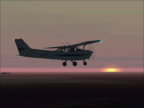
(picture courtesy Les Chatfield)
For many student pilots, the qualifying cross country flight (QXC) is a daunting experience. It's your first long flight alone, you're visiting airfields you might be unfamiliar with and - on top of all that - you've actually got to do the navigation!
No wonder many students dread the experience.
But never fear, in a few moments I'm going to give you a couple of tips to reduce the stress and eliminate the fear. First want to tell you about my QXC
I did my QXC in Florida. Now for those of you who've never been to Florida let me try and describe the land.
Flat.
Featureless
Flat and featureless.
Sure there are some towns there (Orlando being the main one I was focused on) but outside of that it's just flat and featureless. Occasionally you'll come across a body of water (actually quite a lot of bodies of water) but they are so indistinct as to be almost unusable for navigation. (As an exercise, go to Google Maps and type in "Land o' lakes, Florida", click on satellite and see what the ground looks like.)
Needless to say this makes the QXC a bit of a challenge. The key in this case is to make sure you are flying on the right track and keep a careful control of your timing. For example on the first leg of my QXC (Kissimmee to Ocala), I knew that I needed to position myself just left of Magic Mountain and take a particular heading for a length of time. This would bring me to the edge of Eastlake Weir which had hwy 42 running South and hwy 441 running west of it. The key was knowing that as long as I kept the direction and distance I would arrive at the lake. It was big enough to act as a navigation point and I could correct any drift as and when the lake came in sight.
Remember the key thing about the QXC: It's not meant to check how well you can follow a line on a map. It's meant to check how well you can navigate from point A to point B. This includes making navigation corrections when you go off track. As an example, when I first flew the QXC route I did it with my instructor. We got to Crystal River (which is a lovely place on the Gulf Coast with a friendly little airport) and the next stop was back to Orlando. However, as we took off from Crystal River my instructor noticed that the Gulf coast was actually a lot of reclaimed land that had huge, expensive houses on them, so we went for a little cruise over the bay to check out the houses.
Then I started navigating back to Orlando.
Of course at that point all my calculations were completely hopeless. I was starting from the wrong place and on the wrong heading. My instructor knew this, of course, and said nothing. I just followed my original track and kept checking the map vs the ground below to determine where I was in relation to where I should have been. About 15 minutes into the leg I finally located our actual track and was able to make adjustments. We made it back to Orlando in time to circle the airport for 20 minutes waiting for the business jets flying into Disney for the weekend to land!
Anyway back to the tips:
Tip 1: Aviate, Navigate, Communicate
It's the old adage. Make sure you fly the plane first and foremost. Keep doing your FREDA checks. Ensure you're flying straight and level at the height you planned and the speed you planned. There is no excuse for not making sure your number one priority is to actually fly the plane.
Tip 2: Plan, Plan, Plan
The key to making a good QXC is to plan, plan, plan. Have your route plotted thoroughly before hand. Mark it in pencil on your map - heavy black pencil so you can see it. At the start of each leg write the heading and expected flight time in a box as an easy reference. Mark expected landmarks you wish to navigate by (river and road crossings, major arterial highways, castles, masts, odd geographical features etc). Consult Google Maps or Microsoft Maps in satellite mode to see what the landmarks look like from the air. Have all the appropriate radio frequencies to hand. Draw a layout of the destination airports to know where the runways are and what the joining instructions are likely to be. Be prepared.
Tip 3: Fly the route before hand
Nothing beats having flown somewhere before to give you a feeling of experience. Your QXC needs to be at least 150nm to 2 separate airports one of which is 50nm from the other. This sounds imposing but really, it's a flight to an airport in the distance, a second flight to a nearby airport and then a long trek back home. If you think of it in those terms it's not so bad. With your instructor, find the ideal locations to fly to. He or she will help you with the planning of your pre-QXC flight and this will make the actual flight itself far easier.
Tip 4: Chose easy airports to fly to.
Depending on where you're located, it's not always easy to find good airports to fly to. But for your QXC you need fields that are not too big (otherwise you end up paying high landing charges AND have to deal with air traffic control etc. This can generally cut out places like Shoreham and Bournemouth) but not too small that they are hard to see visibly from the air (Flying to Popham or Old Sarum, for example is difficult if you don't know what you're looking for or where it is). Find a reasonably sized airfield with a hard runway if possible: Bembridge, Blackbushe, Thruxton, Wellsbourne Mountford, Oxford, or Lydd are good examples down South. Also find airfields that are not close to controlled airspace (Fairoaks is a lovely field with a long hard runway, but is under the Heathrow Class A airspace: it's an added distraction you don't need on your QXC)
Tip 5: Read Jeremy Pratt's 'Navigation Meteorology' part of the Private Pilots Licence Course handbooks.
Apart from having a wealth of information and additional tips he has also added a section called 'Visual Navigation - A Practical Example' (pp nav83 to nav91) which takes you through a complete flight using map extracts and photographs of ground features to help identify navigation features etc. This is extremely useful as a means of focusing the mind on the correct navigation items and the correct mindset.
Navigation in itself is not difficult. Flying an aircraft along a straight and level flight in itself is not difficult. Speaking to ATC on the radio in itself is not difficult. The difficulty comes when you are trying to do all three at the same time. This is what makes the QXC flight so daunting. Follow the tips above and these will, hopefully, give you an added level of confidence to offset the trepidation.

Interesting info.
ReplyDeleteI'm almost ready for my QXC, however mine is going to take me from class D (local airport) through Class A (SVFR), across the international boundry into French Airspace (uncontrolled) into Class D airspace before finally getting to the aerodrome which is in class D again. Following by a flight down france via more controlled airspace to my final airport before returning crossing the international boundary to get home.